
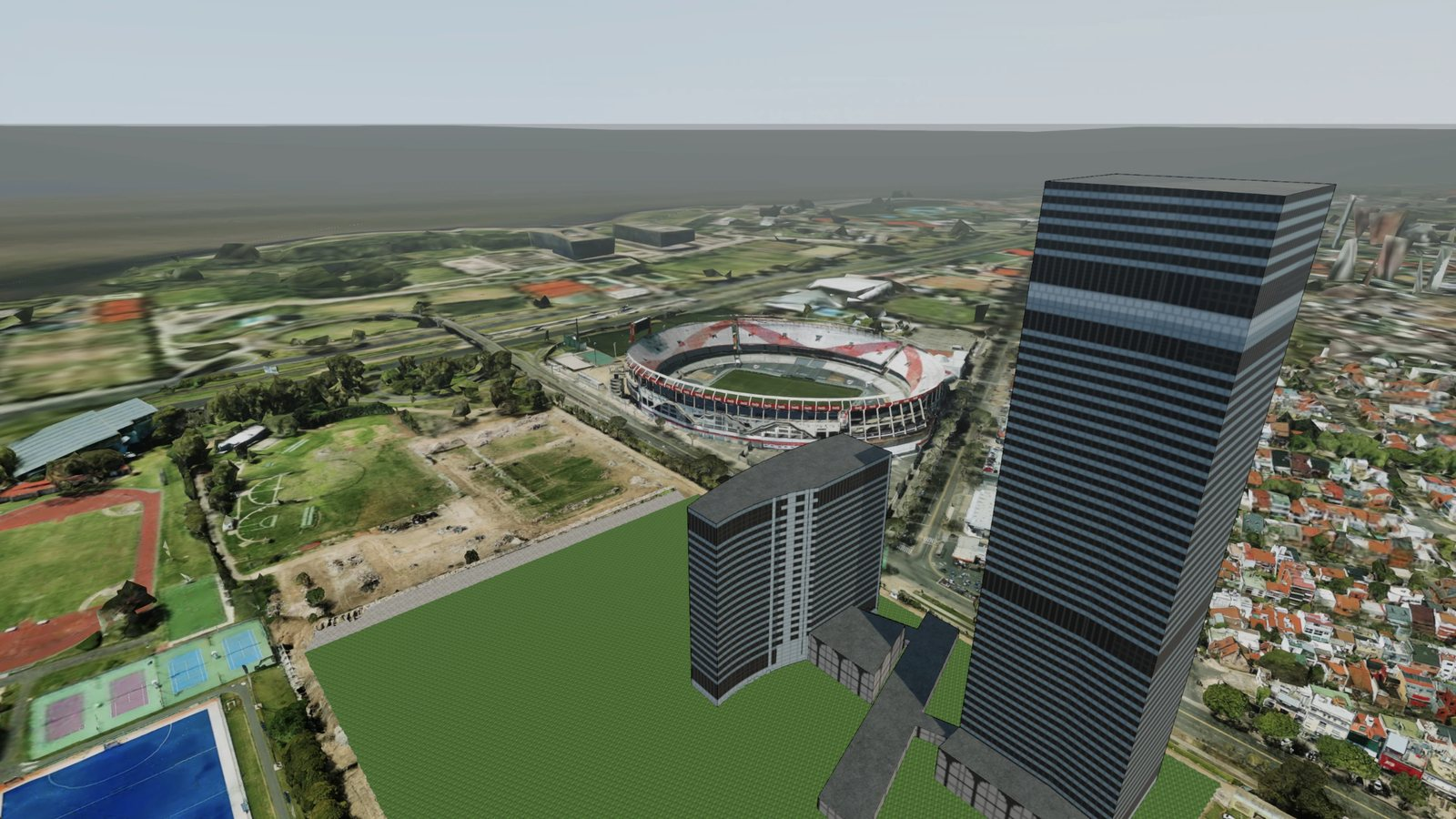

3D landscape model on site context
Keep the camera, path layout, terrace edge, planting masses, and building relationship recognizable. Add warm afternoon light, richer ground material, soft canopy shadows, and a polished client presentation mood.
Upload a landscape model, place it in 3D Preview, move around the site, and save the views that explain the design. Render a House helps you turn those outdoor viewpoints into realistic concept images for review, presentation, and client feedback.
Preview your file type here. Finish the 3D or image workflow in the app.
Drop a model or outdoor image here
Use a GLB, GLTF, or OBJ model for an interactive landscape viewer, or a clear image for a static landscape concept.
Landscape viewer example
This page checks the source file locally in your browser. You will confirm the upload, view, prompt, references, and current credit cost in the signed-in workspace before a generation runs.
A single screenshot can hide how a landscape proposal works. Use the viewer first to check arrival, level changes, planting mass, boundaries, and the relationship between the outdoor scene and nearby buildings.
Keep the camera, path layout, terrace edge, planting masses, and building relationship recognizable. Add warm afternoon light, richer ground material, soft canopy shadows, and a polished client presentation mood.
Search for an address or start without a location when the landscape is fictional, early-stage, or context-free.
Upload a GLB, GLTF, or OBJ version of the landscape model and keep the native design file as the technical source of truth.
Move, scale, rotate, and height-adjust the model. Orbit, pan, and fly through the outdoor space before saving views.
Save the strongest perspectives, then use those camera views as the base for realistic landscape render concepts.
Keep the request grounded in the source file. The viewer and render output are strongest when they support a visual decision instead of replacing technical landscape documents.
Place a GLB, GLTF, or OBJ model against map context when the address, arrival path, neighboring buildings, or ground relationship matters.
Move through the model, then save arrival, terrace, overhead, and presentation views as separate perspectives inside one project.
Use planting mass, paving, lighting, season, and outdoor material direction to judge whether the scene communicates the design intent.
If you only have a yard or exterior photo, use Render a House to generate a static landscape concept from that view instead of an orbitable model.
Share the project so collaborators can inspect the 3D scene and compare renders without reducing the discussion to one screenshot.
Once you save a useful outdoor view, describe the visual direction you want while naming what should stay fixed. That makes the render easier to compare with the model.
Keep the path layout, terrace edge, grade relationship, building position, and camera angle recognizable. Add layered planting, warm path lighting, richer paving texture, and soft afternoon canopy shadows.
Keep the path layout, terrace edge, grade relationship, building position, and camera angle recognizable.
Ask for layered planting, warmer paving, evening path lighting, canopy shade, seasonal color, or a calmer courtyard atmosphere.
Use the render for visual review. Keep grading, drainage, species, quantities, dimensions, and construction details in your technical files.
People use “landscape viewer” for map viewers, 3D model viewers, and photo-based landscape visualizers. Render a House is built for visualizing the design from model or image inputs, not for replacing specialist analysis tools.
Best when you have a GLB, GLTF, or OBJ model and need to inspect outdoor space from multiple angles before rendering.
Best when you have one exterior photo and want a static before-and-after concept for planting, paving, lighting, or yard style.
Use dedicated GIS, CAD, BIM, or landscape design tools for layer analysis, grading, drainage, quantities, permits, and construction documents.
A landscape viewer is a way to inspect an outdoor site, landscape concept, or 3D environment visually. In Render a House, the strongest workflow is a 3D landscape model viewer: import a GLB, GLTF, or OBJ model, position it in 3D Preview, save useful camera views, and turn those views into renders.
Render a House 3D Preview works with GLB, GLTF, and OBJ files. Export native SketchUp, Revit, Rhino, Blender, or CAD/BIM files to one of those web-ready formats before opening them in the viewer.
Yes. If you only have a photo, use it as an image-based landscape concept workflow. The result is a static visual concept from that camera angle; it cannot be orbited like a 3D model.
No. Render a House is for visual review and rendering. It does not import GIS layers, calculate grading, verify drainage, produce planting schedules, estimate quantities, or create permit-ready construction documents.
Yes. Share the project and include the 3D model so a reviewer can open a read-only scene, inspect the model, compare saved renders, and leave comments where needed.
No. Treat satellite context as visual context only. Use survey data, the authoring model, and qualified professionals for exact boundaries, levels, slopes, offsets, codes, and buildability decisions.
Try it out, go Pro when it starts paying for itself.
02
Most popular
Pro
For professionals and small teams
$26/mo
$312/yr
4 months free
03
Studio
For studios and bigger teams
$66/mo
$792/yr
4 months free
What credits buy you
Pro 240 credits | Studio 1000 credits | |
|---|---|---|
| Render Pro 2 credits each | 120 | 500 |
| Render Standard 1 credit each | 240 | 1000 |
| Render Standard 2K 1.5 credits each | 160 | 666 |
| Render Pro 4K 4 credits each | 60 | 250 |
| Render Standard 4K 2 credits each | 120 | 500 |
| Video 0.8 credits/sec | 300s | 1250s |
Use the broader 3D model viewer page when your main need is model import, orbiting, and saved render-ready views.
Use the broader renovation workflow when the landscape idea is part of a room, exterior, or whole-property refresh.
Explore facade, curb appeal, material, lighting, and planting concepts around the house exterior.
Ready to inspect the site